Nysa (Nysa)
 |
 |
Nysa, one of the oldest towns in Silesia, was probably founded in the 10th century. The name of the Nysa river, from which the town takes its name, was mentioned in 991, when the region formed part of the Duchy of Poland under Mieszko I of Poland. A Polish stronghold was built in Nysa in the 11th and 12th century due to the proximity of the border with the Czech Duchy. As a result of the fragmentation of Poland, it became part of the Duchy of Silesia, and from the 14th century it functioned as the capital of the Duchy of Nysa, administered by the Bishopric of Wrocław. In the 12th century the Gothic Basilica of St. James and St. Agnes was built (later rebuilt after the war devastations of the 13th and 14th centuries). Now designated a Historic Monument of Poland, it is the most distinctive and most valuable landmark of Nysa. Nysa was granted town rights around 1223 by bishop Lawrence, confirmed by Duke Bolesław II Rogatka of Legnica in 1250, and attracted Flemish and German settlers. In 1241 it was ravaged by the Mongols during the first Mongol invasion of Poland. In 1245, it was granted staple right and two yearly fairs were established. In the early-14th century Nysa became an important trade- and craft-center of Poland, before it passed under the suzerainty of the Bohemian Crown in 1351, under which it remained until 1742. It also became one of the leading cultural centers of Silesia.
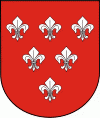
The town's fortifications, dating from 1350, served to defend against the Hussites in 1424. During the Hussite Wars, in 1428 it was the site of the, with Poles and Czechs fighting on both sides. One of the prominent signs that Nysa was a significant center is the report in Nuremberg Chronicle, published in 1493, which mentions the city among the major urban centers of Central and Eastern Europe. In the description of the town population included in this chronicle we read "plebs rustica polonici ydeomatis ...". The Nysa coat of arms at the entrance of the Charles Bridge in Prague, which is displayed alongside the arms of the most prominent Bohemian cities, also indicates the importance of the town. In the 16th century it was a Polish printing center.
During the Thirty Years' War (1618–1648) Nysa was besieged three times. It was plundered by the Saxons and Swedes. Polish prince (and later King) Władysław IV Vasa ((r. 1632 – 1648)) visited the town several times between 1619 and 1638. In 1624 the Kolegium Carolinum Neisse (today's I Liceum Ogólnokształcące), one of the most renowned schools of Silesia, was established as a Jesuit college. Polish King Michał Korybut Wiśniowiecki and Polish prince James Louis Sobieski both attended this school.
During the First Silesian War (War of the Austrian Succession), in 1741, Nysa was besieged and captured by Prussians, King Frederick II of Prussia laid the foundations of its modern fortifications. In 1758, during the Seven Years' War, it was besieged by the Austrians. On 25 August 1769 it was the site of a meeting between Frederick II and Emperor Joseph II, co-regent in the Habsburg monarchy of Austria.
During the Napoleonic Wars Neisse was taken by the French in 1807. It retained its mostly Catholic character within the predominantly Protestant province of Silesia in the Kingdom of Prussia. Because of its many churches from the Gothic and Baroque periods the town was nicknamed "the Silesian Rome". In 1816–1911, the town was the seat of the Neisse District, after which it became an independent city. According to the Prussian census of 1910, the city of Neisse had a population of 25,938, of whom around 95% spoke German, 4% spoke Polish and 1% were bilingual.
During World War I and the post-war Polish Silesian Uprising, a prisoner-of-war camp was located in the town. Charles de Gaulle, future leader of French Resistance against German occupation in World War II and later president of France, was imprisoned there in 1916. After World War I, Neisse became part of the new Province of Upper Silesia within Weimar Germany.
During World War II the Germans established a subcamp of the Gross-Rosen concentration camp, three forced-labour camps, and several working parties of the Stalag VIII-B/344 prisoner-of-war camp at Łambinowice. Conquered by the Red Army in the last months of the war, the town was placed preliminarily under Polish administration in accordance with the Potsdam Agreement and renamed to the Polish Nysa. The town's German population was partly evacuated. After the German defeat, and following the preliminary establishment of the Oder-Neisse line as the new German-Polish border, the remaining German population of Nysa was expelled. Expulsions started in mid-June 1945, carried out by the Soviet-organized Polish militia who surrounded settlements, entered homes, and asked their inhabitants to leave their home with them.
In the following years, new Polish settlers, some whom were themselves expelled or resettled from what is now Western Ukraine (see: Kresy), made Nysa their new home.
Map - Nysa (Nysa)
Map


Country - Poland
 |
 |
| Flag of Poland | |
Poland has a temperate transitional climate and its territory traverses the Central European Plain, extending from Baltic Sea in the north to Sudeten and Carpathian Mountains in the south. The longest Polish river is the Vistula, and Poland's highest point is Mount Rysy, situated in the Tatra mountain range of the Carpathians. The country is bordered by Lithuania and Russia to the northeast, Belarus and Ukraine to the east, Slovakia and the Czech Republic to the south, and Germany to the west. It also shares maritime boundaries with Denmark and Sweden.
Currency / Language
| ISO | Currency | Symbol | Significant figures |
|---|---|---|---|
| PLN | Polish złoty | zÅ‚ | 2 |
| ISO | Language |
|---|---|
| PL | Polish language |
